Back الناظور (المغرب) Arabic ناضور ARY الناظور (مدينه فى اقليم الناظور) ARZ ناظور AZB Надор Byelorussian Nador Catalan Nador (kapital sa munisipyo) CEB Nador Danish Nador German Nador Esperanto
Nador
الناظور | |
|---|---|
| Coordinates: 35°10′0″N 02°56′0″W / 35.16667°N 2.93333°W | |
| Country | |
| Region | Oriental |
| Province | Nador |
| Government | |
| Area | |
| • Land | 44 km2 (17 sq mi) |
| Elevation | 42 m (138 ft) |
| Population (2014)[1] | |
• Total | 161,726 |
| • Rank | 19th in Morocco |
| • Density | 3,675/km2 (9,520/sq mi) |
| • Ethnicities | Riffians: 98%; Spaniards: 1%; Other foreigners: 1% |
| Time zone | UTC+1 (CET) |
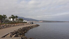
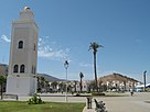
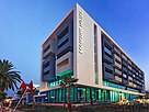
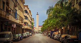
Nador (Arabic: الناظور or الناضور) is a coastal city and provincial capital in the northeastern Rif region of Morocco with a population of about 178,540 (2020 census).[1]
Nador city is separated from the Mediterranean Sea by a salt lagoon named Rbḥar Ameẓẓyan in Berber (Mar Chica in Spanish) and is 10 kilometres (6.2 mi) south of the Spanish city of Melilla.
Nador was founded in the 19th century by local Berber tribes and was under Spanish occupation from 1912 until Morocco's independence in 1956.[2]
The Nador Province has over 600,000 inhabitants, predominantly of Rif-Berber ethnicity. Nador is considered the second largest city in the Oriental East after Wejda.

- ^ a b "POPULATION LÉGALE DES RÉGIONS, PROVINCES, PRÉFECTURES, MUNICIPALITÉS, ARRONDISSEMENTS ET COMMUNES DU ROYAUME D'APRÈS LES RÉSULTATS DU RGPH 2014" (in Arabic and French). High Commission for Planning, Morocco. 8 April 2015. Retrieved 29 September 2017.
- ^ "Nador, City in Morocco - Information and What to do".
